Alaska’s infrastructure of transportation and communication systems- what is the cause-effect relationship to settlement patterns and to the development of the Alaska economy?
 |
| |
Waterways, such as oceans and rivers, were the main transportation used in Alaska. They had already been established by the Natives but had increased use during the Russian American period. Rivers were used to travel and ship goods in the interior. There were challenges in the beginning with using the ocean and rivers. They weren’t well traveled waterways and navigation was rough. They had to familiarize themselves with landmarks, key channels, and submerged rock. These all caused many accidents. Because of the numerous accidents, charting began, lighthouses were installed and underwater hazards were marked. Soon after WWII, depth finders and radar became common on large ships.
| Chilkat cottonwood canoe sailing on water near Klukwan, Alaska, 1894 |
The Yukon River operated from May to September. It moved supplies to trading posts, furs to market, freight, fur traders, and prospectors. The Gold Rush increased travel by rivers. Steamboats became heavily used during this time. Companies started to expand to Alaska to take advantage of the demand for steamboats. The Gold Rush brought many people up to Alaska looking to strike it rich. Because of this, towns started popping up around Alaska. The steamboats brought jobs to Natives and unlucky prospectors. They were hired to cut wood at wood camps along the river. The natives were hired as pilots to guide boats, firemen, and deckhands.
The Jones Act of 1920 came into effect. This act only allowed American built ships to enter between any two U.S. Ports. This allowed the American companies to profit from all of the business instead of other countries. Before the Intercoastal Shipping Act of 1933, there were no definite shipping schedules and no approved published cargo rates. Companies were adjusting their rates to suit them and the public never knew what the rates were going to be from day to day. They were also setting their own schedules with no public knowledge of those either. As a result, people wouldn’t know when to expect delivery. After the Act, definite shipping schedules were created as well as approved published cargo rates.
After WWII, only the Alaska Steamship Company and Northland Transportation Company remained. This was due to the end of federal subsidies, increased labor costs and competition from truckers using the Alaska Highway and air. Today, we rely heavily on ocean shipping, especially to ship oil from Prudhoe Bay. It is also relied heavily on for food, shelter and energy.
| Buildings and tents on wagon road, White Pass Trail, ca. 1898 |
Because of WWII, a road connecting the air bases in Fairbanks and Anchorage was needed. The Glenn Highway was completed and made it possible for the first time to drive back and forth to both cities. The Alaska Highway was also completed. Upgrades of the roads were required in order for them to be used in all weather conditions. After Alaska obtained statehood in 1959, the state became responsible for the road systems.
| Copper River Northwestern Railway, n.d. |
The Alaska Railroad had a hard time getting started. There were a few different owners who had good intentions of making the railroad a success but they ran into financial trouble. The Alaska Railroad Commission was created to investigate the railroad situation. The ARC was eventually replaced by the Alaska Engineering Commission set in place by President Woodrow Wilson. The railroad was complete by 1923.
Unfortunately, the railroad system hadn’t turned out to be everything Alaska had hoped it would be. The rails began to become damaged because of all the use they were getting, especially during WWII. The use of automobiles and airplanes became the better, easier way to travel and to get around to different places in Alaska. The railroads are still used today to transport freight and cargo. They are also used to transport people, especially tourists.
Roads and Railroads were limited according to where they were constructed. Weather, permafrost, and tundra were major factors determining the direction of the construction.
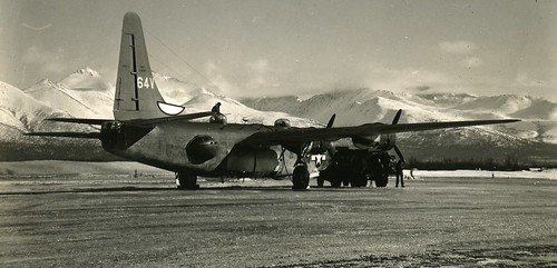 |
B-24, PB4Y2, Bomber in Alaska about 1945 |
In 1924, float planes touched down in several towns in Alaska. By 1927, Alaska was maintaining 27 airfields. Because of high interest in flying, an aviation school was opened up in Fairbanks in 1928. More and more flights were being made throughout Alaska, commercial air service began, and the first publicly supported airfields were built.
Commercial flights began to increase inside and outside of Alaska. Because of aviation in WWII, limits were tested of airplanes and pilots started recognizing the potential of their planes. Eventually the airfields needed to be upgraded in order to keep up with the newly designed aircraft that needed more advanced landing strips. Air travel made for quicker and easier transportation of goods and people.
Communication systems in Alaska have developed considerably. In 1867, the first post office was authorized in Sitka. Mail service eventually expanded to the western and interior portions of Alaska. Mail routes consisted of reindeer, dog, horse, and railroad. Air mail began in Alaska in 1924, 5 years after it’s start in the lower 48.
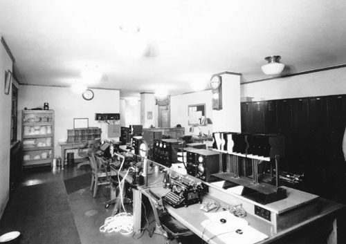 |
| Alaska Communication System operations room - Ketchikan |
The telephone was introduced to some communities as early as 1890. WWII resulted in the completion of the first overland telephone line from Alaska to the lower 48 which ran along the Alaska Highway.
 |
| One of the radar stations I saw in Nome. Very impressive! |
 Radar stations were used to provide warning of air attacks. Satellite communications were brought to Alaska as well, but their use was limited and expensive. It wasn’t until 1974 that satellite earth stations were located in rural villages which brought public telephones, emergency medical communication and television to remote areas. Broadcast radio and television become a part of the telecommunications. Something that I found interesting was that oil burners, milk shake mixers and hair dryers interfered with radio reception in Juneau. Television programs from outside the states had to be recorded and flown in and aired sometimes several weeks after their original date.
Examine Question:
Identify the three major railroads in Alaska history – Where? When? Why? Ownership? Current status?
White Pass and Yukon Territory Railway:
 |
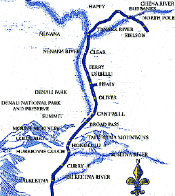
| Map |
 | |
| WP&YR Train |
After the Gold Rush had subsided, the Railway was not used as often. It transported ore from Canada mines to Skagway. It also carried tourists who arrived in Skagway to Whitehorse. The railroad began to pick up more business during WW II. The owners loaned the railroad to the US government. It was used to haul war supplies to Whitehorse. After the war, the railroad went back to carrying tourist and freight. In 1970, a highway connected Whitehorse and Skagway. Operations were suspended in 1982 due to the mining collapse. In 1988, it reopened as a seasonal tourism operation. It is an International Historic Civil Engineering Landmark. It’s a destination shared with the Panama Canal, Eiffel Tower, and the Statue of Liberty. Today, it is Alaska’s most popular shore excursion, carrying over 360,000 passengers over tourist season in 2010.
I found this cite and it has a lot of really interesting information on it about the WP&YR.
The Copper River and Northwestern Railway:
 |
| Map |
| Construction of the Million Dollar Bridge |
The mine produced 70 percent pure copper in it’s deposits making a big profit for the railroad. By 1938, the mine was depleted and the railroad was abandoned. The line between Cordova and Cordova Airport was in operation during WWII. 60 miles of the line between Chitina and McCarthy were used for light tram traffic unit 1947. Today, the railroad is not in operation.
The Alaska Railroad:
 |
| Map |
This completed the now known Alaska Railroad. The railroad not only carried mail, lifestock, machinery and people, but alongside the tracks was the nation’s longest, publicly owned, telegraph line. Since the railroad stretched from Seward to Fairbanks, shipments were made within four to five days where before the railroad it took a month or more to complete.
 |
| Use during WWII |
 Today, the Alaska Railroad continues to support the Alaskan community. They are a powerful economic engine, hauling nearly 8 million tons of freight a year. They transport building products and support resource industries such as coal, oil and gas. They carry more than 500,000 travelers annually and create over 800 jobs for the Alaskan people. The railroad supports various organizations, communities, and charitable fund events along the railbelt. Spending supports nearly 1,900 Alaskan jobs and pumps over $83 million in payroll into the state annually. It works to improve the quality of life for residents along the railbelt by leasing land to communities at less than fair market value for parks, bike trails, and other public interest. (Information)
Evaluation:
I thought there was a lot of information in this Module, as usual. Very interesting. I was able to find some websites that had more information about current use of railroads and others with some good pictures. I was in Nome for the end of the Iditarod and was fortunate to see the radar station up close and personal. I was also fortunate to listen to our Arctic Cat driver talk about how his family came over for the gold rush and he grew up on a small gold mine that his family still owns.
Reviews:
I really like Shannon's blog. She has some good pictures and I like her links. Also, her blog is visually appealing.
Kristin did a good jog explaining the reasons why people moved up to Alaska.
Robin's blog had a lot of nice links for extended information. I also like the picture of miners and prospectors on the Chilkoot Trail. It's really good visual of just how many people there acutally were. Thanks for finding and sharing.
Thank you so much for the link to the University of Washington's digital collection! I was so surprised that the canoe in the top picture was made of cottonwood, I immediately clicked on the link to verify it. I always thought cottonwood would be too soft and twisted. Maybe it was easy to work with.
ReplyDeleteI really like the "softness" of your blog. The neutral colors of background and text work so well with the historic photos. You've also been very thorough in your responses. I enjoyed lingering here.